- HKH HYCOS
- About
- Bangladesh
- Kurigram
- Sirajganj
- Lalon Shah Bridge
- Bhairab Bazar
- Bhutan
- Korilla
- Sumpa
- Uzorong
- Trashi Yantshe
- Hongtsho
- Gunitsawa
- Panbang
- AWS-Trashi Yantshe
- Gongrichu
- Nepal (Hycos)
- Jiri
- Pachuwarghat
- Mulghat
- Dhankuta
- Busti
- Tumlingtar
- Turkeghat
- Okhaldhunga
- Bahrabise
- Pakistan
- Nowshera
- HS-Gupis
- AWS-Gupis
- HS-Kalam
- AWS-Kalam
- Kailash Sacred Landscape Project
- Jumla
- Humla
- Chainpur
- Chamelia
- Patan Baitadi
- Rara
- GTS
- Dadeldhura
- Surkhet
- Jumla
- Pokhara Airport
- Bhairawa Airport
- Simra Airport
- Kathmandu Airport
- Okhaldhangu
- Biratnagar Airport
- Taplejung
- Dhankuta
- Dhangadi
- Dipayal
- Dang

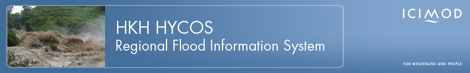
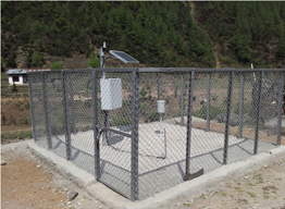
Gunitsawa
| Address | Gunitsawa, Paro |
| River Basin | Parochu |
| Station Type | Automatic Water Level Station |
| Latitude | 27° 36' 3.60" N |
| Longitude | 89° 17' 9.60" E |
| Altitiude | 2800m |
| Landmark | Army Check post |
| Accessibility | 28km from Paro, 14 km of gravel road |
| Local Contact Person | N/A |
| Sensors Used | Bubbler, Tipping Bucket |
| Installed On | 26th April 2012 |
Disclaimer :
The data posted is in real-time basis(raw data) which has not been throughly checked & therefore should not be used for scientific purpose
The data posted is in real-time basis(raw data) which has not been throughly checked & therefore should not be used for scientific purpose
